

SR-237 Express Lanes

Image
Map of SR 237 Express Lanes

The SR-237 Express Lanes run eastbound from Mathilda Avenue in Sunnyvale to Dixon Landing Road in Milpitas and westbound from McCarthy Boulevard in Milpitas to Java Drive in Sunnyvale. The lanes operate Monday – Friday from 5 a.m. to 8 p.m. Carpool occupancy is 3 or more people.

I-680 Contra Costa Express Lanes

Image
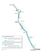
I-680 Contra Costa Express Lane_8-20-2021

The I-680 Contra Costa Express Lanes run southbound from Marina Vista Avenue in Martinez to Alcosta Boulevard in San Ramon and northbound from Alcosta Boulevard in San Ramon to Livorna Road in Walnut Creek. The lanes operate Monday – Friday from 5 a.m. to 8 p.m. Carpool occupancy is 2 or more people.

I-580 Express Lanes

Image
I-580 express lanes map large

The I-580 Express Lanes run eastbound between Hacienda Drive in Pleasanton and Greenville Road in Livermore and westbound between Greenville Road in Livermore and I-680. The lanes operate Monday – Friday from 5 a.m. to 8 p.m. Carpool occupancy is 2 or more people.

Carquinez Bridge

An aerial view of the Carquinez Bridge

The Carquinez Bridge consists of two spans on I-80 crossing the Carquinez Strait between Crockett and Vallejo, connecting Contra Costa and Solano counties. The westbound bridge, built in 2003, includes a separated path for bicycles and pedestrians. All tolls are collected electronically in the northbound direction.

Benicia-Martinez Bridge

An eye-level view of the Benicia Martinez Bridge

The Benicia-Martinez Bridge (George Miller Jr. Bridge) crosses the Carquinez Strait on I-680, linking Benicia in Solano County with Martinez in Contra Costa County. The bridge features parallel spans for northbound and southbound traffic and provides separated bicycle and pedestrian access. All tolls are collected electronically in the northbound direction.

Richmond-San Rafael Bridge

An aerial view of Richmond-San Rafael Bridge

The Richmond-San Rafael Bridge, on I-580, connects Richmond in Contra Costa County with San Rafael in Marin County. The bridge features a separate pathway for bicycles and pedestrians. All tolls are collected electronically in the westbound direction.

Dumbarton Bridge

An eye-level view of Dumbarton Bridge

The Dumbarton Bridge on State Route 84 is the southernmost crossing of San Francisco Bay, linking Menlo Park in San Mateo County with Fremont in Alameda County. The bridge also provides bicycle and pedestrian access. All tolls are collected electronically in the westbound direction.