Bay Bridge Trail Maps
Getting to the Trailheads
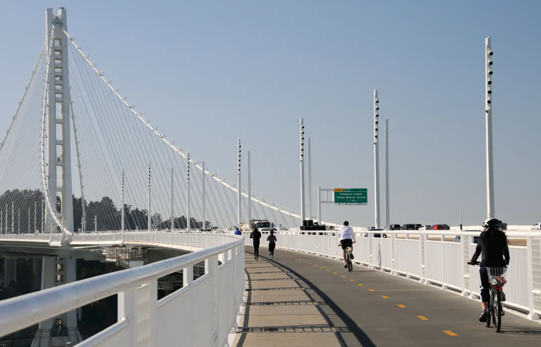
Designed for pedestrians and cyclists, the Bay Bridge Trail access points provide direct routes to the bridge trail skyway.
Access Points
-
Shellmound Street Trailhead
Access FromMacArthur BART Station
Bike InfoRide west on 40th Street, which turns into Shellmound Street. The trailhead is across the street from IKEA.
37.8290643, -122.267047
Transit InfoTake the Emery-Go-Round Powell shuttle or the AC Transit Line 26 and off-board at IKEA. The Trailhead is across the street from IKEA.
-
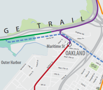
Burma Road Trailhead
Access From19th Street BART Station
Bike InfoRide north on Broadway and west on West Grand Avenue to Maritime Street. Turn left on Maritime and ride to Burma Road. The trailhead is at 210 Burma Road, approximately half a mile west of the intersection of Maritime Street and Burma Road.
37.8088478, -122.2685139
Transit InfoTake the AC Transit Transbay NL bus and off-board at Maritime Street. The trailhead is at 210 Burma Road, approximately half a mile west of the intersection of Maritime Street and Burma Road.
ParkingLimited five-hour parking is available from dawn until dusk at the Bay Bridge Trail parking lot at the Bridge Yard building at 210 Burma Road, approximately half a mile west of the intersection of Maritime Street and Burma Road.
-
Eastbound Bay Bridge Toll Plaza, AC Transit Bus Stop
Access FromDowntown San Francisco
Bike InfoAC Transit can accommodate two bikes at a time with bike racks on the front of its buses.
NoteNote: No westbound access
37.7945742, -122.3999445
Transit InfoTake the AC Transit Transbay NL or O bus from the Salesforce Transit Center and off-board at the Toll Plaza stop on the Bay Bridge.
-
Yerba Buena Island, Bay Bridge Vista Point (via Shuttle)
Access FromBay Bridge Trail-Treasure Island Shuttle Stop at Avenue of the Palms and 9th Street on Treasure Island (via the Salesforce Transit Center)
Bike InfoMuni buses can accommodate two bikes at a time with bike racks on the front of its buses.
37.7889543, -122.3972246
Transit InfoTake Muni Route 25 from Salesforce Transit Center and off-board at 9th Street & Avenue H on Treasure Island. Head westbound to the shuttle stop at Avenue of the Palms & 9th Street. Board the Treasure Island Shuttle to the Bay Bridge Vista Point on Yerba Buena Island.
Shuttle hours are 7:00 am- 6:00pm weekends and holidays, and run every 30 minutes. Learn more about the Bay Bridge Trail-Treasure Island Shuttle Service
Bay Bridge Trail Safety
- 15-mph advisory speed limit
- Bicycle-mounted California Highway Patrol officers monitor the trail
- Skateboards, scooters and skates are not permitted
- Cyclists must yield to pedestrians
- Fishing from the bridge is not permitted
Bay Bridge Trail Hours
The Bicycle and Pedestrian Path of the East Span on the Bay Bridge is open daily from 6:00 AM to 9:00 PM.
The Bay Bridge Trail access points are open 24 hours a day, 7 days a week from the trailhead on Shellmound Street in Emeryville to the Caltrans Bridge Yard building at 210 Burma Road, Oakland.